Today we were heading to the White Sands National Monument,
this was the main reason we came down to Alamogordo.
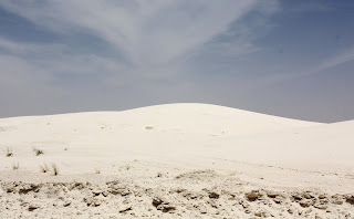
The White Sands National Monument is a desert of sand, white
sand. It is actually gypsum that has
been carried down by rain water from the surrounding mountains. Normally the gypsum would be carried to the
sea but the valley is contained so the water seeps underground leaving the
crystals. These crystals that then broken
down by the wind until they are the fine grains of sands we see today. The mounds of white sand covers of an area 275 square miles. Very impressive.
I stole this picture off of the internet as it gives a much broader perspective of the massive size of the dunes than I was able to capture. The lack of proper lenses and knowledge made it very difficult to get depth and expanse at the same time.
Prior to venturing into the dunes we stopped at the service centre.
We started our drive into the park and found that the outer
edges had quite a bit of plant growth.
As we progressed into the dunes the vegetation became scarce
and started to see mounds of clean white sand.
As the wind is constantly moving the dunes the roads have to be graded on a regular basis. Driving on them reminded me of ice covered, rutty roads we would see in Northern Ontario after a snow storm. Just not as slippery.
A lot of people come into the dunes to spend the day relaxing; you would think they are at the beach. Well, actually they are, only there is no water. They do some sunbathing, sand sliding, picnicking and hiking.
 |
| I think they are nude sun bathing. |
After lunch we started on a little hike. We wanted to climb the dunes to get a broader perspective of the entire area. One of the first things we noticed is that the sand was not hot but it did reflect heat upwards. It was only in the low nineties but it felt like a 110 degrees. At all the trail heads is a sheet that you have to fill out that shows when you left and then you fill in the time when you return.
We started out along one trail and found a dune we liked to
climb. The view was amazing, white for as far as you could see. The wind would create these little islands
that were 20 – 25 feet lower than the dunes.
As time progressed I could see why they have a sign in, sign out sheet. I started to lose all depth perception. It just started to become one big white blur, very similar to snow blindness. It would be so easy to get lost in here and I am sure some do. I was amazed at how quickly this happened and if we had not been within sight of the car park I may have been in trouble. We didn’t spend a lot of time on the dunes of even walking the trails as it was just too hot. So we left the park and planned to venture a little north and take in the Three Rivers Petroglyph’s.
Wellllll. You know what
happens when you plan. Things changed
quickly and it wasn’t my fault. We saw
this sign.
And the car turned right all by it. I tried to keep it on the highway but it
turned west and would not relent, so west it was. Actually it soon became a nice surprise as
the drive took us into the Sacramento Mountains and the Lincoln National
Forest.
It was interesting as to how the scenery changed on a very
abrupt note. As we driving up the mountains
the terrain was very rugged and barren but still very pretty.
Near the top we entered a tunnel and when we came out it
seemed you were on a different road. It
became a world of lush green vegetation covering the mountains. Also
very pretty.
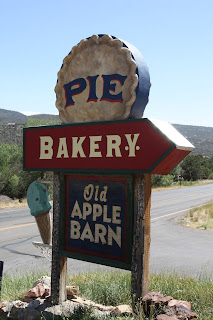
Soon we came to our destination, the Old Apple Barn.
It only seemed fair that since we had driven all this way
that we had to buy a pie. I am not sure
we needed two but that is what we ended up with. We did resist the home made fudge with many different
flavors. They were selling it by the
calorie. Once we had our pies we started
back towards the RV Park and called it a day.
A very good day.


No comments:
Post a Comment