We are on the road to Bloomfield, NM which had us travelling
some pretty nice terrain. The first
place we stopped to take pictures was at Abiquiu Lake.
You can’t see the boats in the pictures but the lake was busy.
Little did I know that this would be the last stop for the
next 50 miles. We had turned onto Hwy 96
which would eventually take us to Hwy 550.
Hwy 96 is a secondary road with no shoulders and had even started to
erode in some places.
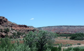
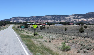
The fortunate part is that the scenery is quite spectacular; at least judging by the pictures Kathy took out the window. The unfortunate part is that I really couldn’t take my eyes off the road to enjoy it.
We reached Hwy 550 turned right and made the straight run into Bloomfield. It was the relaxing part of the drive and I could enjoy the scenery.
We arrived in Bloomfield and settled in for the night. We are planning to stay for a week as they
are quite a few things we want to do. We
start tomorrow.
One of the areas we were looking
forward to exploring is the Bisti Badlands which is where we are headed
today. Unfortunately we got some bad
information and tried to get to the area from the wrong highway. The bad news
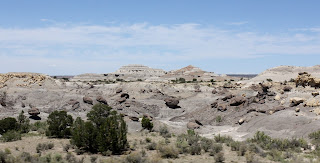
is that we spent a fair amount of time travelling the back country. The good news is that we saw some pretty
unique country side.
We finally found a gentleman who was checking oil lines that was able to set up straight. He explained that we were on Navajos land and that was why there were no signs. Armed with the new info we decided for forgo the Badlands and detour over to another sight we wanted to see, Angel Peak.
There were two areas from which you could observe the
peak. The first was from an overlook
that gave a view of a canyon and the peak in the distance.
 |
| Angels Peak |
Once we left the overlook we turned off the main highway and
started for the peak. The first thing we
noticed is that the GPS didn’t recognize most the back roads. The second thing is that the roads were not
that good. Gravel, sometimes sand and
not very wide.
The area we were looking for (we thought) was the Angel Peak
Conservation area. We were led to
believe that there was a campground and hiking trails at the base of the
Peak. Again we got bad info. There was no campground, no hiking trails and
we were nowhere near the Peak. We were
able to walk up a road that we couldn’t drive and this gave us a better view of
the Peak and the surrounding area.
Pretty nice.
It was time to head back so we set the GPS and the fun
began. It was like playing a video game
trying to keep the car on the purple line in the GPS. It was even harder to control as Kathy kept
yelling at me to stop and take a picture.
Of course I did what I was told.


No comments:
Post a Comment