As we were leaving Monument Valley we took a few pictures of
well known monuments and monoliths. They
cannot be seen from inside the valley but we got a good view of them as were
leaving the RV Park.
 |
| The Hen |
 |
| King on his Throne |
 |
| The Chief |
 |
| Stagecoach, Bear and Rabbit, the Castle |
The rest of the drive was pretty uneventful. We passed the Valley of the Gods, took a few pictures and carried on.


Kathy took a few pictures out the window of the coach which
will remind us of the terrain we passed through on our way to Moab.


Today, its Canyonland time.
Canyonland National Moment is broken down into three areas. The Needles, Island in the Sky and The Maze
and each area is accessible by different roads. The reason is that they are separated by the
Colorado and Green Rivers. We are going
to do the Needles today, but it looks like we might get a little wet.

The way into the park is to travel 40 miles south on Hwy 191
until you come to Hwy 211 which you take for 34 miles to the entrance. The first stop on the way is
Newspaper Rock. In Navajo, the rock is
called “Tse’ Hone” which translates to a rock that tells a story.
The carvings represent 2000 years of early mans activities
and left by people from the Archaic, Anasazi, Fremont, Navajo, Anglo and Pueblo
cultures. There is no known method to
dating rock art and in interpreting the figures on the rocks scholars are
undecided as to their meaning or have yet to decipher them. It was pretty interesting.


We reached the Park Entrance and stopped at the Visitors
Center.

We watched a short film on the park, discovered that you
cannot really get a good view of the Needles unless you hike in. We may do that later in the week. We got the map for the drive portion of the
park and we got information on the one hike we did want to do.
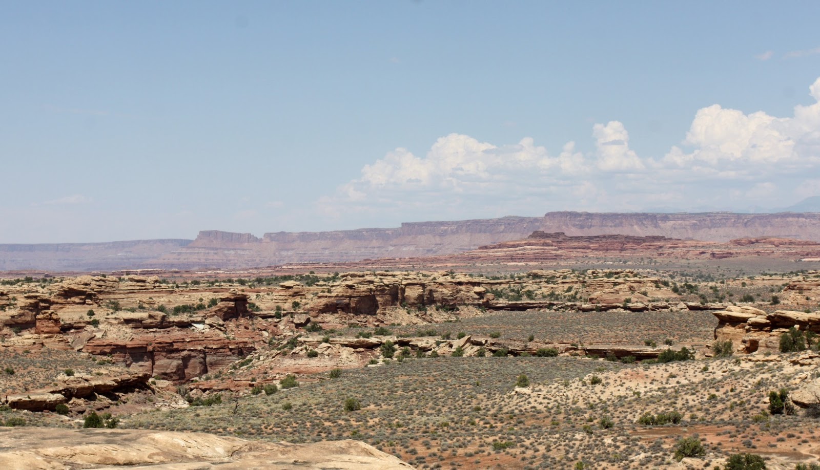
The scenery during the drive was unique, diversified,
spectacular, stunning and I took 188 pictures.


 |
| Wooden Shoe Arch |


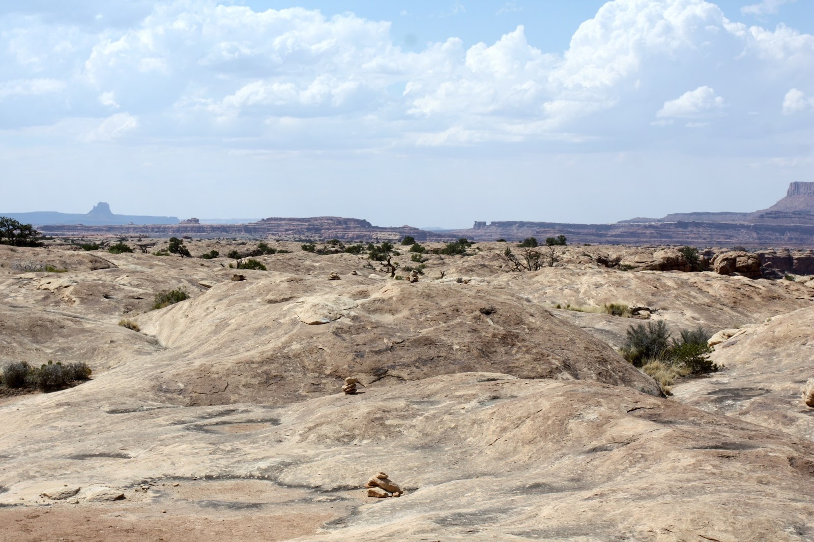
We had reached the area we wanted to hike; it was called Slickrock Foot Trail. It was a 2.5 mile loop trail that gave us great views of Island in the Sky, La Sal Mountains, The needles, Big Spring Canyon and Little Spring Canyon. It was only 2.5 miles but very up and down and mostly on a surface called sliprocks which I was concerned might be a little hard on the knees, turns out it was my ankles that took a beating. There were four overviews on the hike and each one gave us a different and special look.
One thing we did decide on is that there will be no more
hikes except first thing in the morning.
It was 99 degrees and no shade.
The heat reflecting off the rock made it seem like 110 and that along
with the climbing up and down kicked our butt pretty good. We thoroughly enjoyed the hike but we were
pretty tired when we got back. The views
were pretty special.
 |
| And Away we go. |


We reached the first overview and got our first look at the needles, albeit from a pretty good distance. The other views from this point were also pretty nice.
 |
| The Needles |


At overlook number 3 we were treated to a panoramic view of
the entire area.


.JPG)
The remainder of the hike was pretty much more of the same so we just followed the trail back to the car. We were able to take a better picture to the start of the Needles.
 |
| Going |
 |
| Going |
 |
| Going |
 |
| Gone |

Once we reached the car we hydrated, had some watermelon and continued on the loop drive. The sun was behind us and presented perfect conditions for landscape pictures.


There was one more road we wanted to travel that we hoped would give us a better view and perception of what the needles truly looked like. It was called Elephant Hill Road and it started with a better view of the Needles along with other very interesting and unique shapes and views.


 |
| The Needles |
Once we reached the car we hydrated, had some watermelon and continued on the loop drive. The sun was behind us and presented perfect conditions for landscape pictures.


There was one more road we wanted to travel that we hoped would give us a better view and perception of what the needles truly looked like. It was called Elephant Hill Road and it started with a better view of the Needles along with other very interesting and unique shapes and views.


The clouds were getting pretty dark and we were going to get
wet if we hung around much longer. So we
headed back and it wasn’t very far down the road that it started to rain. It rained very hard at times and pretty much
accompanied us all the way back. It did
stop for a very brief time and at exactly the right time. We were approaching Wilson Arch which can be
viewed from the road. Naturally we
stopped and took pictures before continuing home.

It was a great day, we were very tired, but very
satisfied. I hope we have many more days
like today.
No comments:
Post a Comment