May 25, 2013


MAY 22 BIG BEND NATIONAL PARK – 3RD AND FINAL DAY

Today will be our 3rd and final day in Big Bend National Park.  It took 13 years of planning, ohhh well, 13 years of procrastinating but we finally got here.  It would have been a shame to miss this, it is indeed pretty spectacular.  Kathy was able to take one picture that we feel exemplifies Big Bend National Park.


Unfortunately it looks like today is not the best day to be in the Park as there is a haze covering the mountains.  It almost looks like fog but it is dust.  Hopefully it will clear up later in the day.  You can still see everything close up; it is just the panoramic views that lose their focus.


We continued into the park until we came to the visitors centre and swung south east towards Rio Grande Village.  We dropped down onto the flats with the Chisos Mountains on our right passing by Pummel Peak, Nugent Mountain and Panther Peak.  On the right we had the Sierra Del Carmen Mountains.  I knew this because it says so on our map, we still couldn’t see them.  We could distinguish them but that was about all. 

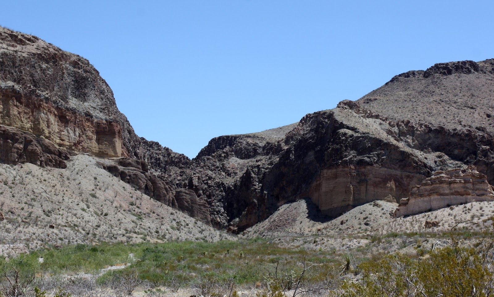
We were able to enjoy the scenery closer to us with stops at Rio Grande Overlook and Boquillas Canyon Overlook.   You could see the village of Boquillas Del Carmen across the river on the Mexican side.


Free enterprise was at work at the turnaround at the Boquillas Canyon Overlook.  Venders from Mexico would bring over knickknacks and lay them out on the rocks with price lists for people to buy.  You could also see the watchers across the river keeping an eye on their product.  They had some neat stuff but if you bought any of it you were breaking 2 federal laws.   They weren’t that nice.

We stopped at the Visitor’s Center only to find out it was closed, so we explored the campgrounds to see what they had.  You could also tell we were pretty close to the river as the vegetation certainly took on a non desert look.  Unfortunately it was only right along side of the river.  


We also got a couple of pictures of the State Bird of Texas


We had some lunch and then headed for the last place in the park that we still had to explore,  Chisos Basin.  We weren’t too optimistic as the haze was still in the air but as it turns out we were very pleasantly surprised.  Once we started to climb into the Chisos Mountains on our way to the basin the sky became very clear allowing us to take some very nice.

The most amazing aspect of the Chisos Basin is the terrain and vegetation.  After spending two days in the park looking at scrub land, cactus and barren mountains it was with awe and amazement to discover mountains with green vegetation.  This area if the park was lush but to the rangers in the park the area was in distress as they have only had 4.2 inches of rain in the past two years.  However to us it was like being in a different park.  The entire Chihuahuan Desert was like this 8000 years ago, very lush and full of vegetation.  Over time the harsh and arid climate has changed most of the desert into what we see today.  The exception is the Chisos Basin which is considered an agricultural island as it is protected by the mountains and it also gets more precipitation.  It was really was amazing.  There are Aspens growing the Basin, the only place in Texas where you will see aspens.  It is the only place in the Park where you will see Mountain Lions, Bears and White Tailed Deer.   We absolutely loved it.
Emery Peak - Highest in Big Bend

Casa Grande


 Once we had our fill we said Adios to Big Bend Park and pointed the car towards Lahitas and the RV Park.  It was a pretty amazing 3 day venture into the park and I am sorry it took us 13 years to get here.  We enjoyed it immensely but tomorrow we are heading north to do a little exploring in New Mexico.

May 23, 2013


MAY 20 & 21, 2013   BIG BEND RANCH STATE PARK

Monday was a rest day.  We got a little too much sun yesterday so we decided to spend the day during our chores and resting up.  I was also able to catch up on the blog.

Tuesday found us heading west towards Big Bend Ranch National Park.  Lahitas is situated on the edge of both Big Bend National Park and Big Bend Ranch State Park.  We turned right out of the RV park and continued on FM 170 towards the gates of the park and Presidio, Texas.


The 50 mile drive along FM 170 had us following the Rio Grande all the way to Presidio.  Most of the time we were driving right beside the river but we did occasionally venture a little inland.  The scenery to this point was very similar to what we had seen on our drive into Lahitas.


The first stop in the park was at the Contrabando Movie Set.  It looks like a ghost town until you look inside and see that the buildings are just shells.  This set was built in 1985 for the movie “Uphill all the Way” but was used for a few other movies.  They include Rio Diablo (1993), Gambler V: Playing for Keeps (1994); Streets of Laredo (1995) Dead Man’s Walk (1996) and Journeyman (2000).  It was also used for the Brooks and Dunn video “My Maria” in 1996.


We also started to a change in the terrain.  We were starting to climb and although we were still seeing volcanic remains both the color and texture were changing.


Good Example of a dike


We continued to climb and once we reached what was the highest point on the road we pulled into an overlook.  It gave us a spectacular view of the terrain and the Rio Grande.  This proved to be the highlight of the trip.  At least scenery wise, the company of my beautiful bride was definitely the real highlight.


We arrived in Presido and only stopped long enough to get gas before heading north on Hwy 67 to Shafter.  However, we did learn that Presido is a very old town as the first Spaniards came here in 1535.  In 1760 a penal colony and a military garrison was established here and in 1830 the name changed from La Junta de los Rios to Presidio del Norte.  The first white settlers arrived in 1848 after the Mexican war but were virtually wiped out by a Comanche raid in 1849.  However, the town survived and continued to grow unto what is now known as Presidio.

Twenty miles north of Presidio on Hwy 67 is the mining town of Shafter, Texas.  Shafter at one time was a vibrant silver mining town with a reported population of 1500 people.   In or around 1945 with the closing of the mine and the two forts nearby the town essentially died.  Today the population is 11 hearty souls. 


We left Shafter and started on our way back to Presidio where we got back on FM 170 which would take us back to Lahitas.   On the east side of Presidio this was a road that would take us into the middle of Big Bend Ranch State Park.   The drive was reportedly quite nice but the problem was that it was an unpaved road.  However, we thought we would give it a try and began the trip into the park and the Visitors Centre.  We never made it, the road got pretty rough and I did not want to do any damage to the car. 


So we turned around and headed back to Lahitas.  On our return trip Kathy took a few pictures out the front window and they turned out pretty good. 


We arrived back at the RV Park and called it a night.  Another good day.

May 20, 2013

 
MAY 19, 2013  BIG BEND NATIONAL PARK  - DAY 2

Today’s adventure once again finds us in Big Bend National Park.  Our route will begin shortly after we get inside the Park gates and we turn onto Ross Maxwell Scenic Drive.  This is the drive the Rangers recommend if you only have one day in the park, the must see drive.  I think we supported this theory by taking 174 pictures.   There was some amazing scenery, amazing varied scenery and scenery that just couldn’t be captured by the camera.

The drive started by turning right at the Castolon/Santa Elena Junction which would take us straight into the Chisos Mountains.  Our first stop was shortly after we turned onto the drive when we noticed a green clump of trees in the middle brown and dry.  What we were looking at was the original homestead of Sam Nail who arrived in the park in 1916.  One of the things he did in order to sustain his was to build a well.  I do not know how long Sam stayed in the area but the both the well and the windmill are still there and still working.  The windmill is still pumping water which keeps the fruit trees that he planted alive and vibrant. 


We left Sam’s place and continued on towards the Chisos Mountains.   They looked like paintings.  Sometimes when you are reviewing pictures they look like paintings and not photographs, no idea why. Here the actual mountains looked like paintings, it was pretty amazing.


It was while we were driving through the mountains that I learned something new.  I learned that there are dikes in the mountains.  What are they????

The spines of rock of dark rock marching across the desert floor are called dikes.  Contemporaries of the Chisos Mountains, these outcrops are evidence of the most recent igneous activity in the area.  Like great stone fences, dikes can be traced for miles across the park – reminders of the molten world beneath the quiet desert surface.

I knew this because I took it right off an exhibit sign. 


I took a few pictures that show the dikes and how they travel across the mountains.  Very interesting.


We slowly, and I mean slowly continued through the mountains, taking pictures and enjoying the fabulous scenery.  In one picture you can the remains of the Homer Wilson Ranch which was one of the original homesteads in this area.  The National Park Service bought it 1942 and incorporated it into Big Bend Park.  The ranch was abandoned in 1945, a year after Homer Wilson died.


A short jaunt up the road we came to Sotol Vista which gave us an overview of the remainder of the park to the south.  The cliffs in the distance of the first picture belong to Mexico.  We could see Trap Mountain, Goat Mountain, Santa Elena Canyon (which was our final destination) and Kit Mountain.  Also visible was Tule Mountain, Burro Mesa, Little Christmas Mountain and Christmas Mountain.  I wish I had a lens that could have captured what we saw, it was a spectacular view.


We left the vista and dropped down onto the valley floor and made short stops at Burro Mesa Pouroff, Mule Ears View Point and Tuff Canyon.  Burro Mesa Pouroff and Tuff Canyon would be an amazing place to visit during the monsoon season.  I just wouldn’t want to be too close.  Mule Ears Peaks are one of the more famous and widely photographed landmarks.


Burro Mesa Pouroff

Mule Ears Peaks

Tuff Canyon


We stopped at a Visitors Centre where we had our first real look at the Rio Grande Valley.  I was amazed to learn that at one time cotton was grown in the valley.  A gentleman by the name of Wayne Cartledge raised cotton from 1922 to 1942 when production costs forced him to forgo the venture. 


One unique area was Cerro Castellan or Castolon Peak. 

Cerro Castellan


The layers visible in Cerro Castellan reveal millions of years of volcanic events.  Stacked in this tower are several lava flows and volcanic tuffs (ash deposits), with layers of gravel and clay from periods of erosion between eruptions.   We also took pictures of further signs of volcanism, pale beds of volcanic ash and dark basaltic boulders.


As we continued we finally got our first look at the Rio Grande.  This time of the year it does not look so large but you can see how the banks expand during the monsoon season. 


The next and last stop will be Santa Elena Canyon where we planned to hike into the canyon.  This is rated as one of the premium short hikes in the park.


Santa Elena Canyon


We arrived at the trail head, loaded up with water, grabbed the camera and headed out.  The hike was only 1.8 miles but there was a lot of climbing.  The heat and altitude really got to us and this hike took us pretty much to our limits.  Thankfully we took lots of water.  The trip took us into the narrowest part of the canyon which separates Mexico and Texas.  It was pretty spectacular and of course we took a few pictures.


When we got back to the car it was 106 degrees and we wondered why were exhausted.  We decided at that point to take Old Maverick Road back to the main road.  This cut about 25 miles off of our return trip.  It was a gravel road and unusable during certain times of the year but this was not one of them.  Of course we stopped for a couple of pictures.


We reached the main road and headed home.  We were exhausted but very pleased with our day, another great retirement day.