The afternoon certainly started that way as we arrived at
the Park.
After checking in we saw that we had to climb to get into
the park which gave us a nice view of the entrance to the park.
As we followed the road up we were starting to get a glimpse
of what we were going to see in the Arches. The entire Arches area has a Monument
Valley look with the shapes and colors, the arches are a plus.
Shortly after reaching the top we came to an area called
Park Avenue. The rocks were assumedly
looking like the building on Park Avenue.
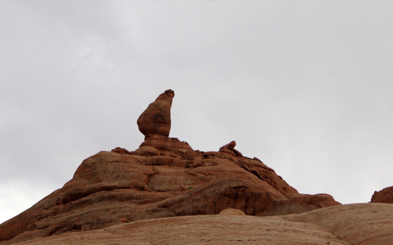
Along with the ridge of Park Avenue we also got a good look at the
valley as well as a balanced rock. It
wasn’t THE balance rock but it was a balanced rock.
Further along the road was a viewing point that gave us a
look at a few of the named and more photographed rocks.
 |
| The Three Gossips, Sheep Rock, Courthouse Towers |
 |
| The Organ |
 |
| The Three Gossips |
 |
| Courthouse Towers |
 |
| The Three Gossips |
 |
| Sheep Rock |
As we were leaving the parking area we got a good look at
the La Sal Mountains in the distance, it also showed that we might be getting
some weather fairly soon.
On the way to the next stop we quickly stopped at the
Petrified Dunes and took a couple of pictures.
Then it was on to “THE” Balanced Rock, Ham Rock and the Garden of
Eden. The more famous of these is
Balanced Rock as you see it in many advertising videos and movies.
 |
| Petrified Sand Dunes |
 |
| Petrified Sand Dunes |
 |
| "THE" Balanced Rock |
 |
| Other Side of "THE" Balanced Rock |
 |
| Ham Rock |
 |
| Garden of Eden |
 |
| Garden of Eden |
It was here that it started to rain and we lost our sun so
we decided to call it a day and come back in the morning.
However, on the way out the rain stopped and we got a
beautiful view of the Garden of Eden and Double Arches with the sun shining on
it. We turned around and took pictures
but we had lost the perfect look we had seen just previously. It was still pretty nice.
It was still raining in the distance so we decided to follow
our earlier instincts and come back tomorrow.
We got an early start in the morning and we were at the next
point on the park road by 7:30AM. Once
we reached the parking lot we saw that this area included The Windows Area,
Double Arch, Elephant Butte and the Cave of Cove. We decided to hike into the Windows area and
then do the loop around the North and South Arch. We came upon Turret Arch first which allowed
us to climb right up to and under the arch.
I am standing under the arch in one picture which emphasis's just how
big the opening is.
 |
| Turret Arch |
 |
| Turret Arch |
We started the hike around the North and South Windows and
got our first look at it the arches.
The hike was a little over 1.5 miles but it gave us a
terrific view of the back side of the arches as well as some of the local
wildlife (note the ears). We were also
treated to a great view of what was on the other side of the arches.
 |
| North And South Windows |
Across the road was the start of the half mile hike into
Double Arches. We hiked as close as we
needed to get some good pictures but did not see the need or have the desire to
climb into it.
 |
| Double Arch |
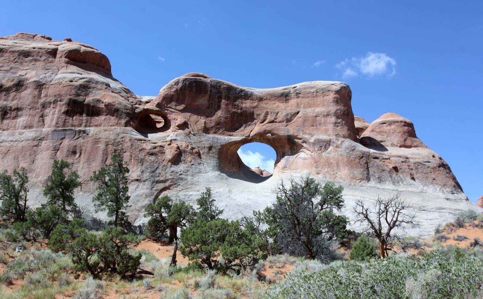
While we were on our way back from the Double Arch we saw
another arch that as far as we were aware has not been named. We also got a
view of the Cave of Coves; the picture of Elephant Butte did not turn out as it
was right into the sun.
 |
| Unknown Arch |
 |
| Cave of Coves |
On the way to the most famous arch we passed Porthole
Arch. It is hard to see mostly due to
the angle.
 |
| Pothole Arch |
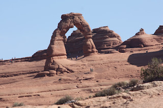
The most famous arch is Delicate Arch and probably the most
photographed arch in the world. It is
the biggest in the USA and maybe the world.
There were two ways to see the
arch. The first is a 2 -3 hour hike to
the base, the second was the lower and upper viewpoints. The only difference between the upper and
lower viewpoints was a half mile hike 250 feet up a steep incline. We chose to do the Upper one as we wanted a
closer view of the arch. It was worth the climb. We did notice that there were many people who
did make the hike. Good on them.
 |
| Delicate Arch |
When we were at the Upper Viewpoint we were still a mile
away from the Arch. I took these
pictures with my 300MM telephoto lens.
You can see how big the arch is by the size of the people in the photo. I will do that hike someday in the near future;
I want to see it close up.
We left the lookout and headed to the next arch. We took pictures as we travelled the road, in
fact we take 348 pictures while we were in the park. There was not a bad view, all you had to do
was point the camera and push the button, pretty amazing. Needless to say I can’t post them all here.
Skyline Arch involved another hike and again the view was
worth it.
 |
| Skyline Arch |
 |
| Skyline Arch |
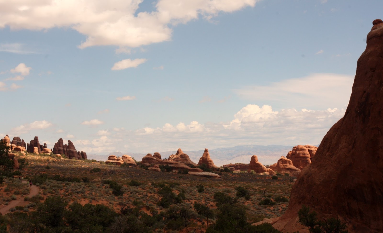
We bypassed Sand Dune Arch and Broken Arch because it also involved
a 1.5 mile hike and we wanted to save our energy for the end of the road and Devil’s
Garden Trail. The entire hike was 7.6
miles return but we were only going part way. Our round trip portion was about
2.5 miles and it involved quite a few hills but delightfully worth it.
We started out and our first stop would be Tunnel Arch but
the arches would only a small portion of the beauty we were seeing.


We got to Tunnel Arch and enjoyed the view for a short time
before continuing on to Pine Tree Arch.
You can see a second arch continuing to form just to the left of the big
arch.
 |
| Tunnel Arch |
Pine Tree Arch is massive.
I am standing under the arch which will give you an idea of how big it
is. We walked through the arch to see
what the view looked like. We also took
a picture of the back side of the arch.
 |
| Pine Tree Arch |
We had to backtrack to the main trail in order to get to
Landmark Arch. The scenery was very much
the same only different, all of it beautiful.
We arrived at Landmark Arch but could only look at it from a
distance. In 1991 a portion of it fell
and as a result they stopped visitors from walking underneath it. There was also a second arch which we think
is Partition Arch but we are not sure.
 |
| Landmark Arch |
This is where we turned around and headed back but I took a
picture of where the trail continued on and a picture of where it ended
up. The first picture is the climb up
the rocks, the second picture shows people on top of Landscape Arch where the
trail continues for another few miles.
Again, this is another trail that I would like to finish some day.
 |
| And up they go |
We followed the path back to the parking lot at a leisurely
pace just enjoy the view.
At this point we thought we were done as we had hiked about
6 miles today and it was pretty hot. However, a little watermelon, grapes and
cheese and we perked up a bit. We
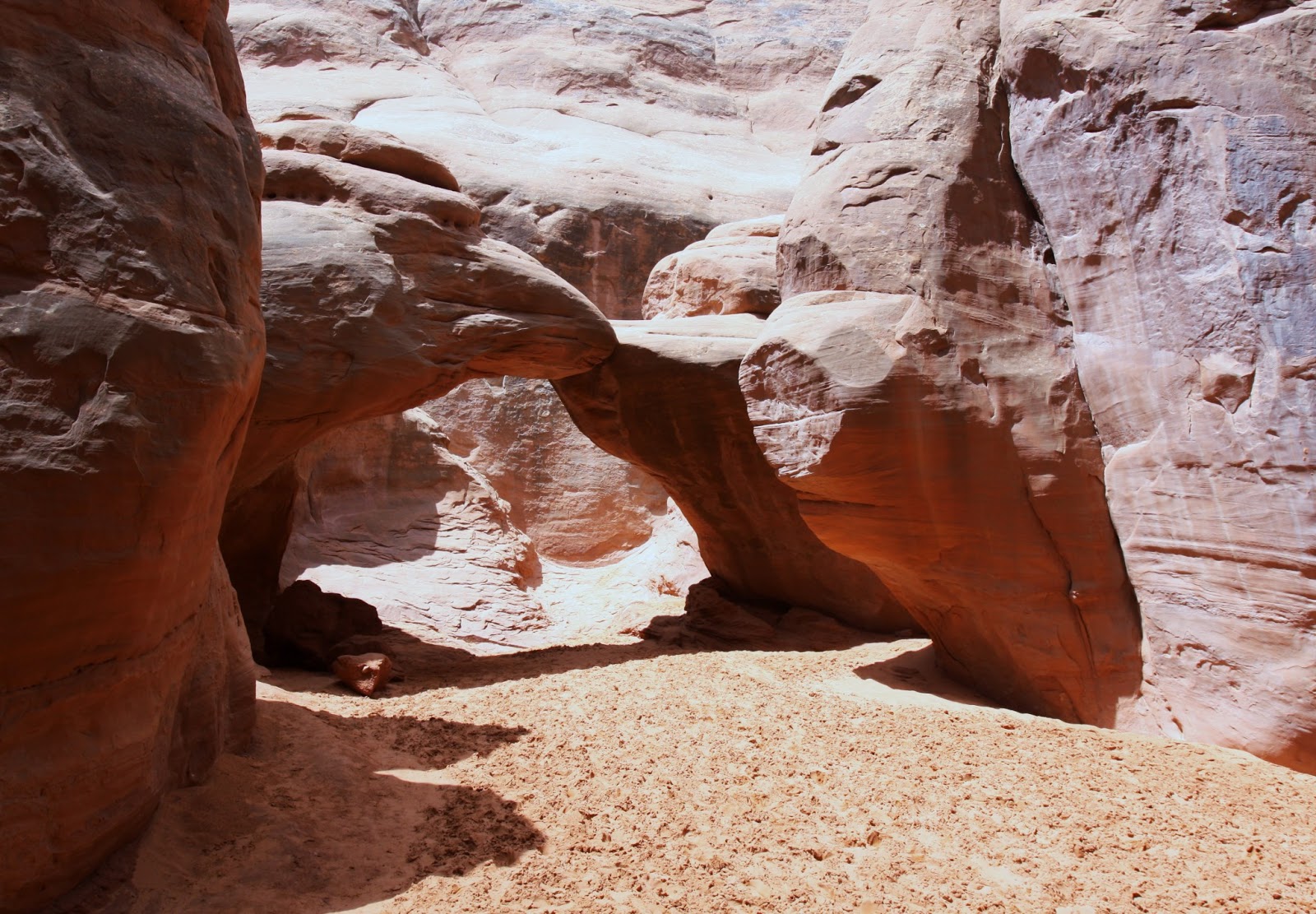
re-cooperated enough to try hiking out to Sand Dune Arch and Broken Arch. Sand Dune Arch was through very soft sand
which made it difficult to walk in; fortunately it wasn’t that far down the
trail.
 |
| Sand Dune Arch |
We finished up at Sand Dune Arch and decided that we had one
more hike in us. It was a 1.5 mile round
trip to Broken Arch so off we went.
Fortunately, the majority of the way to Broken Arch was on flat
terrain. However, as we approached the
arch it got a little rougher.
 |
| Broken Arch |
We walked under and through the arch because we could and
got a few shots of not only the arch but the scenery you couldn’t see unless
you passed through the arch.
The thing that I couldn’t fathom is the name Broken
Arch. As you can see from the pictures,
it is not broken, however it does look like it is cracked. It was cracked enough to concern Kathy and
she insisted on holding it up as I walked underneath it. Enough cheese, we headed back to the car.
We had two more stops to complete our stay in Arches
National Monument. The first was the
Fiery Furnace which is a collection rocks and canyons. In order to hike here you have to have a
permit and/or a guide. We didn’t stay
too long here as we were starting to get pretty tired.
 |
| The Fiery Furnace |
 |
| The Fiery Furnace |
The last stop in Arches was at
Panorama Point which was gave us a higher view of a lot of the park.
We started out of the park very
satisfied and very tired. We had hiked
around 7 miles through up and down terrain.
We loved every minute of it and we both agreed we would love to come
back here and do some of the other hikes.
It was a great end to our time in Utah.
Tomorrow we start our trek into Canada, eh.